A cadastral survey is any survey that deals with property boundaries and land ownership - it's the broad category. A boundary survey is a specific type of cadastral survey that locates and marks the boundaries of an existing property. All boundary surveys are cadastral surveys, but not all cadastral surveys are boundary surveys.
In Brisbane, when someone says they need a "property survey" or "land survey," they usually mean a boundary survey. But if you're subdividing, creating easements, or registering new titles, you need other types of cadastral survey work.
What is a Cadastral Survey?
A cadastral survey is a survey that defines, establishes, or redefines the boundaries of land parcels. In Queensland, cadastral surveys are governed by the Survey and Mapping Infrastructure Act 2003 and the Survey and Mapping Infrastructure Regulation 2014. Only qualified cadastral surveyors can perform surveys that define legal property boundaries.
Cadastral surveys include:
- Boundary surveys (identification and reinstatement)
- Subdivision surveys (creating new lot boundaries)
- Boundary realignment surveys (changing existing boundaries between lots)
- Lease surveys (defining lease areas within a lot)
- Volumetric surveys (defining 3D boundaries for strata and airspace)
- Easement surveys (defining rights of way and service corridors)
What is a Boundary Survey?
A boundary survey specifically locates the boundaries of an existing property. It doesn't create new boundaries - it finds where the legal boundaries already are and marks them on the ground.
Boundary Identification Survey
The surveyor locates your property corners and provides a report confirming where your boundaries are. This is what you need when building a fence, a neighbour claims your structure is on their land, you're planning construction near a boundary, or you want to verify your property's actual dimensions.
Cost in Brisbane: $2,500–$4,000+ depending on lot size and complexity.
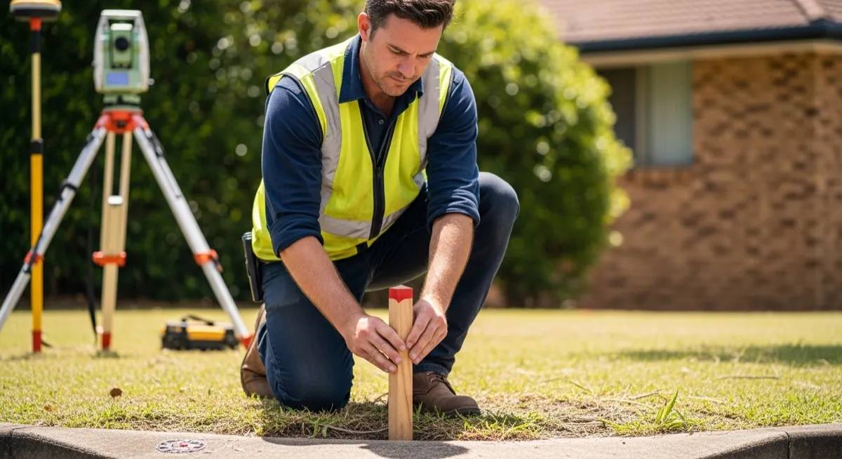
Boundary Reinstatement Survey
The surveyor locates boundaries AND physically marks them by placing survey pegs at each corner. A signed survey plan is produced. This is used when original marks have been destroyed, you need a signed plan for building certification, there's a legal boundary dispute, or council requires formal boundary confirmation.
Cost in Brisbane: $3,000–$4,500+ depending on lot size and the number of corners to mark.
How Do Other Survey Types Compare?
| Survey Type | What It Does | Creates New Boundaries? | Typical Brisbane Cost |
|---|---|---|---|
| Boundary survey | Finds and marks existing boundaries | No | $2,500–$4,500+ |
| Subdivision survey | Divides one lot into multiple lots | Yes | $5,000–$8,000+ |
| Detail/topographic survey | Maps features, levels, contours | No | $1,800–$3,000+ |
| Lease survey | Defines a lease area within a lot | Defines, doesn't create title | $2,500–$5,000 |
| Volumetric survey | Defines 3D boundaries (strata) | Yes | $4,000–$8,000+ |
| Boundary realignment | Changes boundary between existing lots | Changes, doesn't create new | $2,500–$5,000 |
Key distinction: A detail survey (topographic/feature survey) is NOT a cadastral survey. It maps physical features on a property but does not define legal boundaries. You often need both.
What is the Difference Between a Land Surveyor and a Surveyor?
In Queensland, the term "surveyor" can refer to several different professions:
- Cadastral surveyor: Qualified to legally define property boundaries. This is what most people mean by "land surveyor."
- Engineering surveyor: Specialises in construction surveys - set-outs, as-built surveys, volume calculations.
- Mining surveyor: Specialises in underground and open-cut mine surveys.
- Hydrographic surveyor: Surveys waterways, seabeds, and marine environments.
- Building/quantity surveyor: Estimates construction costs. Despite the name, this has nothing to do with land surveying.
When you need a property boundary defined, make sure you're hiring a cadastral surveyor - not an engineering surveyor or quantity surveyor.
How Do I Find My Property Boundary Line in QLD?
1. QLD Globe (Free, Approximate)
The Queensland Government's QLD Globe mapping tool shows lot boundaries overlaid on aerial imagery. Accuracy: ±1–5 metres. Useful for a general idea, but NOT accurate enough for construction, fencing, or disputes.
2. Title Search (Low Cost, No Physical Marking)
Order a title search from Titles Queensland ($20–$30) to see your lot dimensions on the registered plan.
3. Look for Existing Survey Marks
Survey pegs may exist at your property corners from previous surveys. Check corners of your block - they're often buried 50–100mm below ground level.
4. Hire a Cadastral Surveyor (Accurate, Legal)
A professional boundary survey is the only way to get a legally accurate boundary definition.
When Do You Need a Cadastral Survey in Brisbane?
- ✅ Subdividing property - legally required to create new titles
- ✅ Building near a boundary - Brisbane City Council setback requirements
- ✅ Resolving a boundary dispute - a surveyor's determination is the starting point for dispute resolution
- ✅ Building a fence - recommended when there's any uncertainty
- ✅ Selling property - not legally required in QLD, but increasingly requested
- ✅ Creating or extinguishing easements
- ✅ Strata/community title development
Frequently Asked Questions
How much is a cadastral survey in Brisbane? +
Cadastral survey costs in Brisbane range from $2,500 for a simple boundary identification to $15,000+ for a multi-lot subdivision. The cost depends on the type of cadastral work, lot size, terrain, and complexity.
Can I do a boundary survey myself? +
No. In Queensland, only qualified cadastral surveyors can legally define property boundaries. DIY measurements using tape measures, GPS apps, or online maps are not legally valid and can be inaccurate by metres.
How long is a boundary survey valid for? +
A boundary survey doesn't expire - the boundary position doesn't change. However, the physical survey marks (pegs) can be disturbed or destroyed by construction, landscaping, or weather. If your pegs are gone, you'll need a new survey to re-mark them.
What's the difference between a boundary survey and a property valuation? +
Completely different services. A boundary survey defines the physical extent of your land. A property valuation estimates its market value. They're done by different professionals (surveyors vs valuers) for different purposes.
Do both neighbours need to agree to a boundary survey? +
No. You can commission a boundary survey of your own property without your neighbour's agreement. However, the surveyor may need to access the neighbour's land to locate survey marks - if access is refused, the surveyor works from the best available evidence.
Need your Brisbane property boundaries defined? City Surveyors Brisbane provides professional boundary and cadastral surveys with honest up-front pricing. Contact us today.